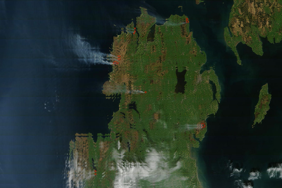
NASA’s MODIS Rapid Response, an emergency response system that provides near real-time satellite “thermal anomaly” imagery, has captured this image of gorse fires raging across parts of the north and west of Ireland. The image was taken yesterday afternoon as strong winds and prolonged recent dry spells have driven gorse, bog, and forest fires “out of control” in Donegal, Down, Galway, Mayo and parts of Fermanagh, Monaghan and Tyrone.

Gorse fires across Ireland. Credit: NASA/GSFC, MODIS Rapid Response
The red boxes indicate instances of significant fire outbreaks. Click the image above to enlarge.
Images of gorse fires on Monaghan/Fermanagh/Tyrone border

Smoke bellows uncontrollably from gorse fires across Sliabh Beagh. Credit: Darren McCarra

Credit: Darren McCarra

Credit: Darren McCarra

Fire fighters tackle a wild gorse fire on the north Monaghan border. Credit: Darren McCarra

Credit: Darren McCarra

Gorse fire continue through the night where Monaghan, Tyrone and Fermanagh meet. Credit: Darren McCarra