Google’s Crisis Response Unit is now focused on tracking Hurricane Irene as it hits the Eastern United States. The search company has released a custom map tracking the storm’s path.
With the map users can track Irene until August 31, as she travels along the Eastern US and moves across Newfoundland, Greenland, and into Mid-North Atlantic. The site also allows users to overlay the latest cloud imagery, as well as Hurricane evacuation routes, storm surge probabilities, Red Cross National Shelter data, and New York City Evacuation Centres.
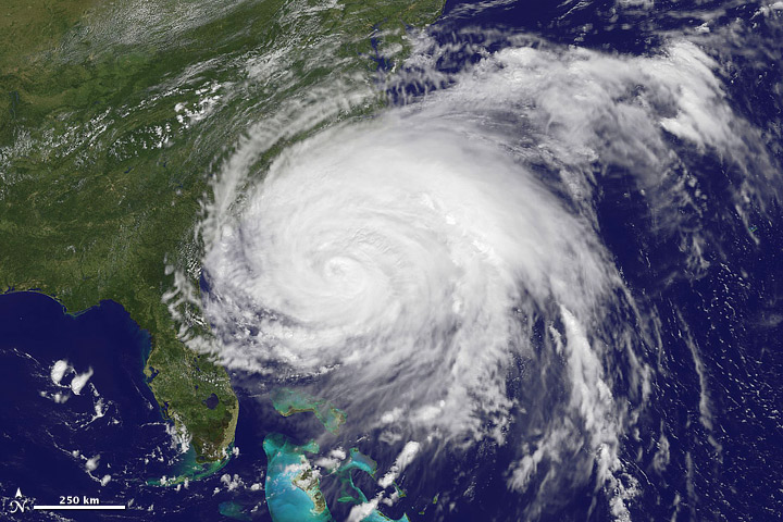
Meanwhile NASA’s Earth Observatory has released this satellite image of Hurricane Irene as it approached Florida on August 26.

Hurricane Irene Credit: NASA Earth Observatory
According to NASA, “After developing into a tropical storm on August 20, Irene moved west and north to buffet Puerto Rico, Turks & Caicos, and the Bahamas. The storm brought extreme winds, storm surges, and flooding rains to each island before taking aim at the Carolina coast of the U.S.”
Over 50 million Americans live in the direct path of the Hurricane, with Norfolk, Washington, Baltimore, Philadelphia, New York, and Boston likely to be impacted. Hurricane Irene is expected to make landfall in North Carolina on Saturday bringing winds of 165kmph (105mph).