Google has begun mapping the spread the catastrophic bush fires which are raging through New South Wales in Australia.
Updating its Crisis Map for the first time this year Google is working with the New South Wales Rural Fire Service to provide the latest information about the outbreak and spread of fires.
These are some of the worst fires that Australia has ever seen. The latest reports from the area say that there are over 130 separate fires burning and these are spreading fast because of high winds and dry vegetation in the area.
Four areas in NSW have been labelled as “catastrophic” meaning that should a fire break out in the area they could become uncontrollable.
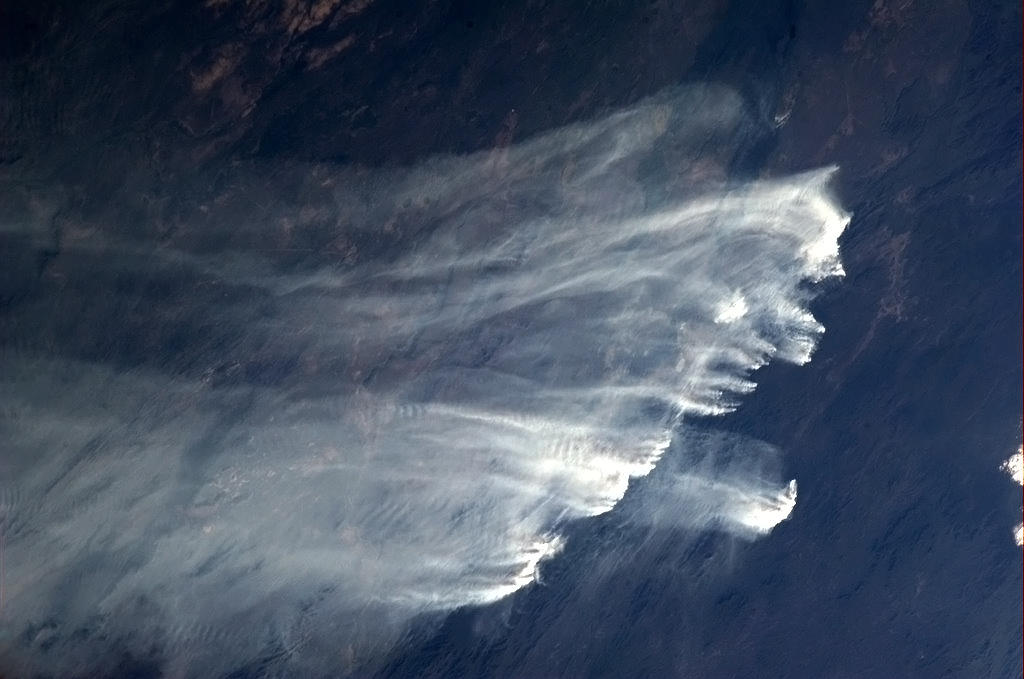
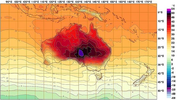
The heat generated by the fires has been so intense that the Australian Bureau of Meteorology was forced to add two new gradations to its heat map while Astronauts on the ISS have taken photographs of them from space (see featured image).
While the Google Map provides some visuals of the locations of some of the worst hit areas The NSW Rural Fire Service’s website has more details about the situation on the ground. It’s reporting where citizens should be careful, what types of fires are to be found in certain areas and whether the fires in those areas are “out of control” or “under control.”
Although both Google and the fire service warn that the map is not a real-time assessment of the fire but designed to show the spread of the fires across South East Australia.
Google’s Crisis Map is part of the company’s Crisis Response service which is used to provide citizens, reporters and aid workers with information in areas of the world that are suffering through man-made or natural disasters.
The service has previously been employed for disasters such as the 2011 Japanese Earthquake, the Haitian Earthquake, the 7.2 Turkish Earthquake and Hurricane Sandy in the US.


