Following NASA’s release of images of tsunami struck Japan Google Earth has released before and after images of the earthquake and tsunami.
Google’s images show in more detail than NASA’s the widespread and catastrophic damage the natural disaster has had on Japan and its citizens. The images show the effects on several areas of Japan, including Fukushima nuclear plant, Sendai Airport, Arahama in Sendai and Yuriage in Natori along with others.
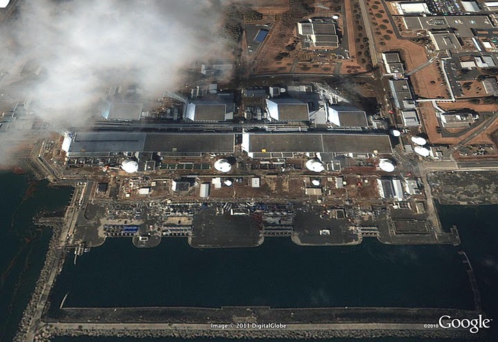
These appear to have been recorded on Saturday, Japanese time, before the Number 1 reactor at Fukushima nuclear plant exploded.

Credit: Fukushima nuclear plant in 2004 © 2011 Google, DigitalGlobe

Credit: Fukushima nuclear plant after tsunami (before outer shell collapse) © 2011 Google, GeoEye
Also shown in Google’s gallery is Sendai Airport, which was hit by tsunami waves soon after the earthquake struck on Friday.

Credit: Sendai airport in 2003. © 2011 Google, DigitalGlobe

Credit: Sendai Airport after tsunami. © 2011 Google, GeoEye
Google has released more before and after images of the earthquake and tsunami on a public Picasa album. While the US Geological Survey has upgraded the earthquake from 8.9 magnitude to 9.0.