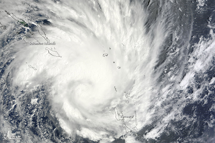
NASA has mobilised its Moderate Resolution Imaging Spectroradiometer (MODIS) Terra satellite to track the massive Tropical Cyclone Yasi, which is currently heading for Australia’s Queensland cost.
According to NASA the tropical cyclone is approaching Cairns, Queensland, at about 165kmph (90 knots) and is due to make landfall early tomorrow morning Queensland time. Australians are expecting this to be one of the worst storms to hit the country in decades and Yasi couldn’t come at a worse time. The country has already been hit by extensive and devastating flooding this year from which the country has not had time to recover.
The interactive satellite image below, which was recorded on January 31, shows the cyclone over the Solomon Islands and Vanuatu in the South Pacific on its approach to Australia.
The satellite image overlay will take a moment to load.
Click here to view a larger map
NASA said of the image,
At midnight on February 1 local time (15:00 on January 31 UTC), the U.S. Navy’s Joint Typhoon Warning Center (JTWC) reported that Yasi was roughly 875 nautical miles (1,620 kilometers) east-northeast of Cairns, Queensland, Australia. Yasi had maximum sustained winds of 90 knots (165 kilometers per hour) and gusts up to 110 knots (205 kilometers per hour). The JTWC forecast that favorable conditions would intensify the storm, which could peak at 125 knots (230 kilometers per hour). Yasi had the potential to make landfall in Cairns with wind speeds in excess of 100 knots (185 kilometers per hour). This storm followed on the heels of widespread flooding in eastern Australia, prompted partly by Tropical Storm Tasha.


