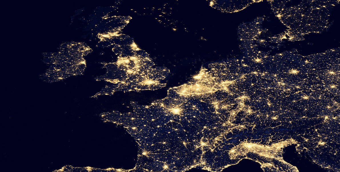
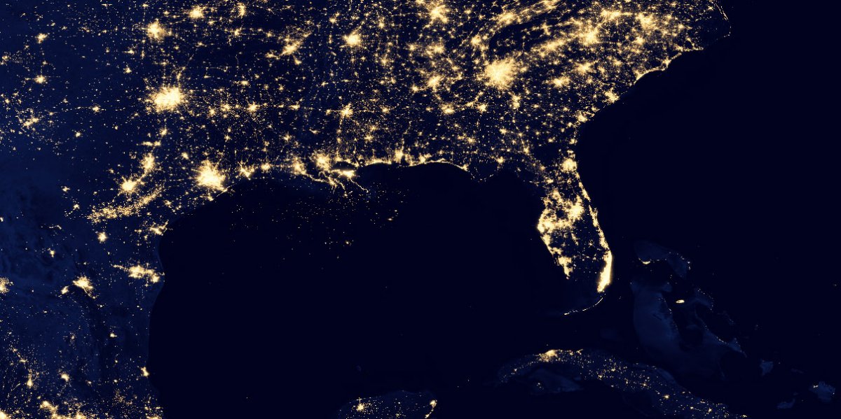
You are looking at some of the most detailed images ever taken by NASA of the Earth at night, and they are just spectacular.
Recorded between April and October 2012 and released today the images show the planet’s cities, towns, villages, and even oil rigs as they light up the night’s sky. NASA says it took 312 orbits of the Earth, and a combined 22 days to “get a clear shot of every parcel of Earth’s land surface and islands.” In total the agency recorded over 2,560 gigabytes of data using its Suomi satellite.
The images were released 40 years after NASA’s famous original Blue Marble photograph. That image is considered to be one of the most distributed on Earth and one of most famous photographs of the planet. NASA updated the Blue Marble image in 2012 to show the planet in more detail.
View all of NASA’s Blue Marble images in one animated gif here.
Unlike the 1972 Blue Marble, which was a single photograph of Earth taken by an Apollo 17 astronaut; the 2012 Blue Marble and 2012 Black Marble images are combinations of hundreds of satellite photographs of Earth.
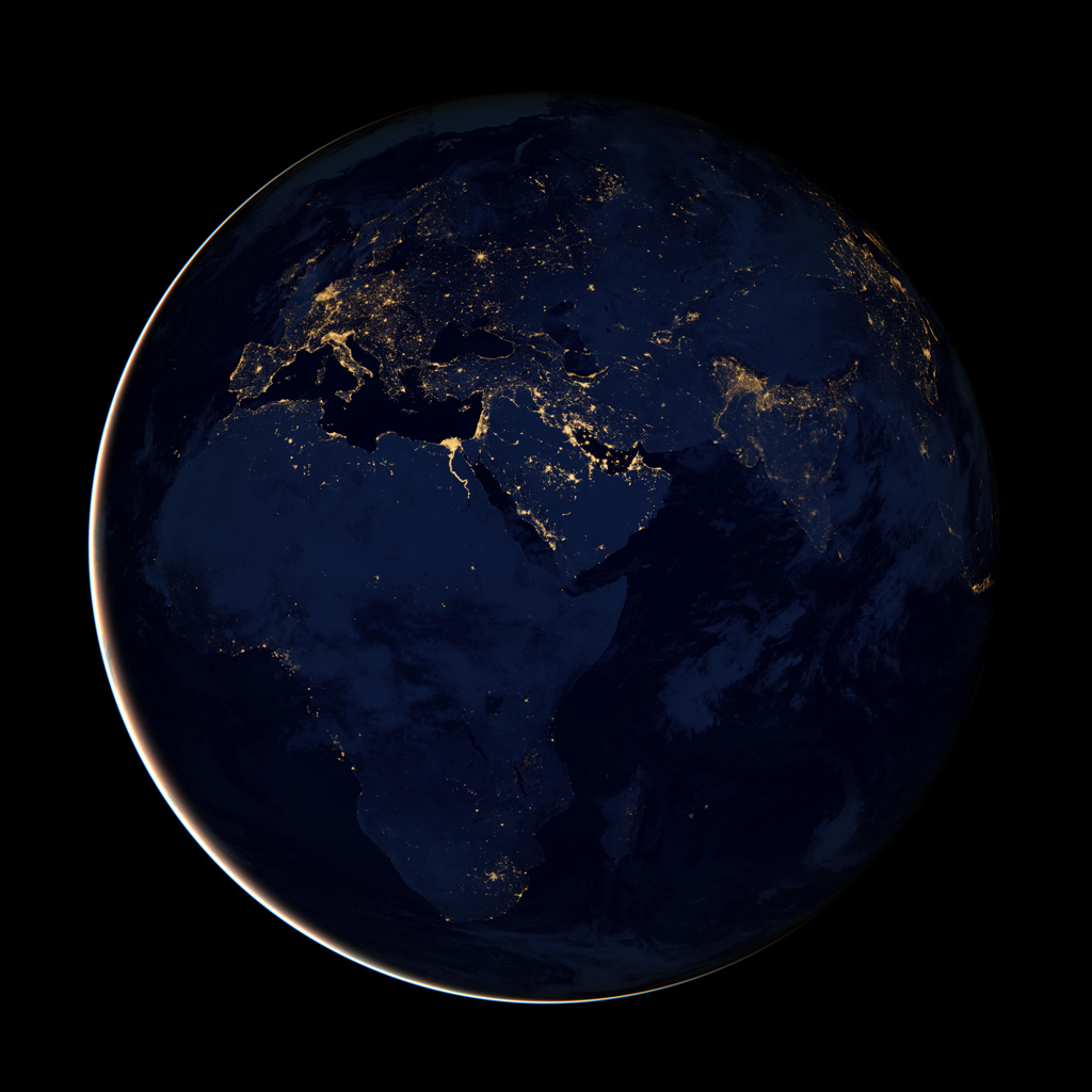
NASA’s 2012 night time Blue Marble Update – “Black Marble”. Credit: NASA Earth Observatory/NOAA NGDC
NASA says this is a rare insight into the Earth at night, which previously was only visible to astronauts and military satellites in such detail.
Indeed, the Suomi National Polar-orbiting Partnership (NPP) satellite is jointly operated by NASA, the US Department of Defense, and National Oceanic and Atmospheric Administration (NOAA).
NASA says;
“Named for satellite meteorology pioneer Verner Suomi, NPP flies over any given point on Earth’s surface twice each day at roughly 1:30 a.m. and 1:30 p.m. The spacecraft flies 824 kilometres (512 miles) above the surface in a polar orbit, circling the planet about 14 times a day. Suomi NPP sends its data once per orbit to a ground station in Svalbard, Norway, and continuously to local direct broadcast users distributed around the world. The mission is managed by NASA with operational support from NOAA and its Joint Polar Satellite System, which manages the satellite’s ground system.”
NASA has put various versions of the image on its website at different sizes -ranging from less than a megabyte to a whopping 384 megabytes in size.
Although it is capable of recording everything from gas flares, wildfires and even moonlight and auroras NASA has digitally removed these from the final image to mainly show only man made lights. The satellite’s ability to record such images is only possible with the addition of a new sensor added to the satellite. NASA says this sensor is so powerful it can detect light from the atmosphere to the lights of a single ship at sea.
“For all the reasons that we need to see Earth during the day, we also need to see Earth at night,” said Steve Miller, a researcher at NOAA’s Colorado State University Cooperative Institute for Research in the Atmosphere. “Unlike humans, the Earth never sleeps.”
Describing the satellite Miller said;
“It’s like having three simultaneous low-light cameras operating at once and we pick the best of various cameras, depending on where we’re looking in the scene,” Miller said. The instrument can capture images on nights with or without moonlight, producing crisp views of Earth’s atmosphere, land and ocean surfaces.
When viewed as one image the globe at night is an amazing sight but zoom in a little and some amazing details becomes visible. Over the Atlantic ships and small islands become clear, while over land small towns and roads light the way.
One of the best ways to interact with the nocturnal map is to use NASA’s KML file which will let you interact with the map on Google Maps or Google Earth (Warning: this link can take a while to download).
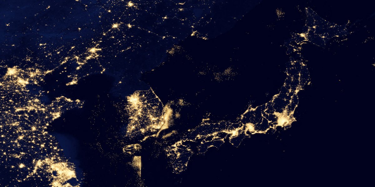
NASA’s image reveals a lot about the Earth but once of the most interesting sights is the lack of light over North Korea; the 38th parallel is, perhaps one of the most visible borders on the planet.
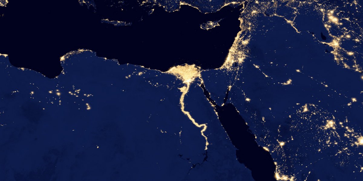
The view of Egypt at night is especially beautiful, with the Nile lit up.
The view of the oli rigs in the Gulf of Mexico look’s like the night’s sky itself.


