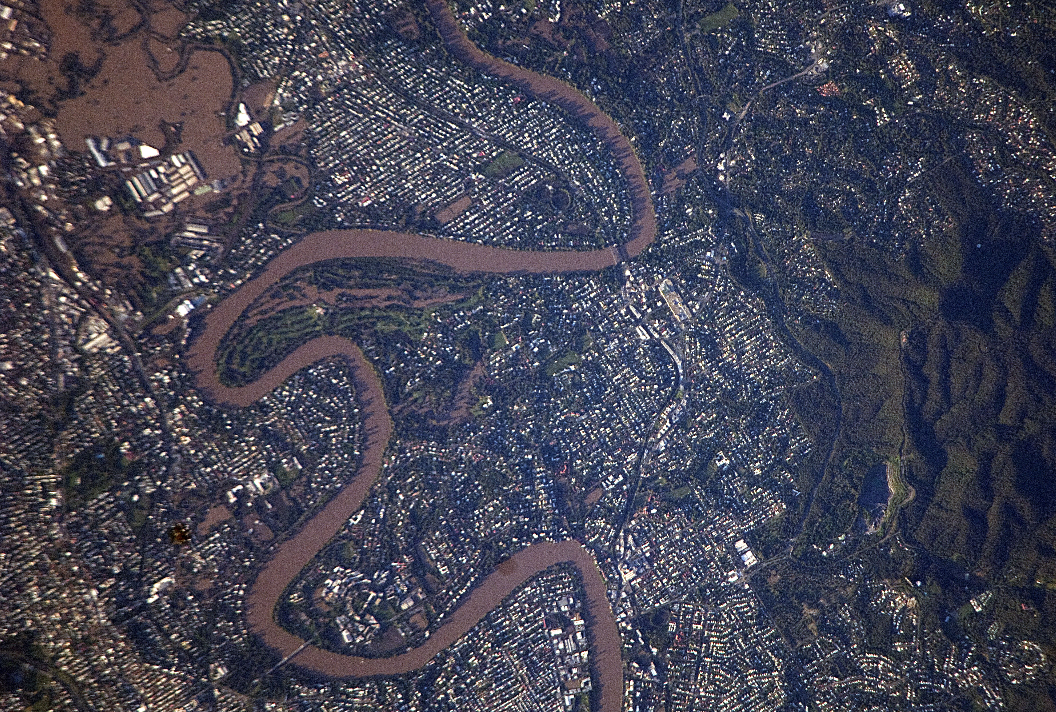
Astronauts on board the International Space Station have captured a true-colour image of the extensive flooding hitting Australia. This newly released photograph shows Brisbane River flooding parts of the suburbs of Brisbane.
The photograph was not taken by a high resolution NASA’s Aqua satellites but by Astronauts using a NIKON D2Xs as the ISS passed over the Australian subcontinent on January 13th.
Click here or on the image to see a larger version.

The light-colored rooftops of residences and other structures contrast sharply with green vegetation and brown, sediment-laden floodwaters. Most visible low-lying areas are inundated, perhaps the most striking being Rocklea at image upper left. The suburb of Yeronga (lower left) also has regions of flooding, as does a park and golf course located along a bend in the Brisbane River to the south of St. Lucia (image center). Flooding becomes less apparent near the higher elevations of Mt. Coot-Tha (image right).